Pentax KX 12MP DSLR with 80-200 manual zoom lens off my old 35mm KX SLR film camera
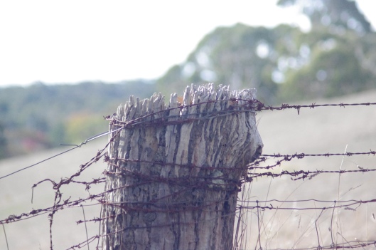
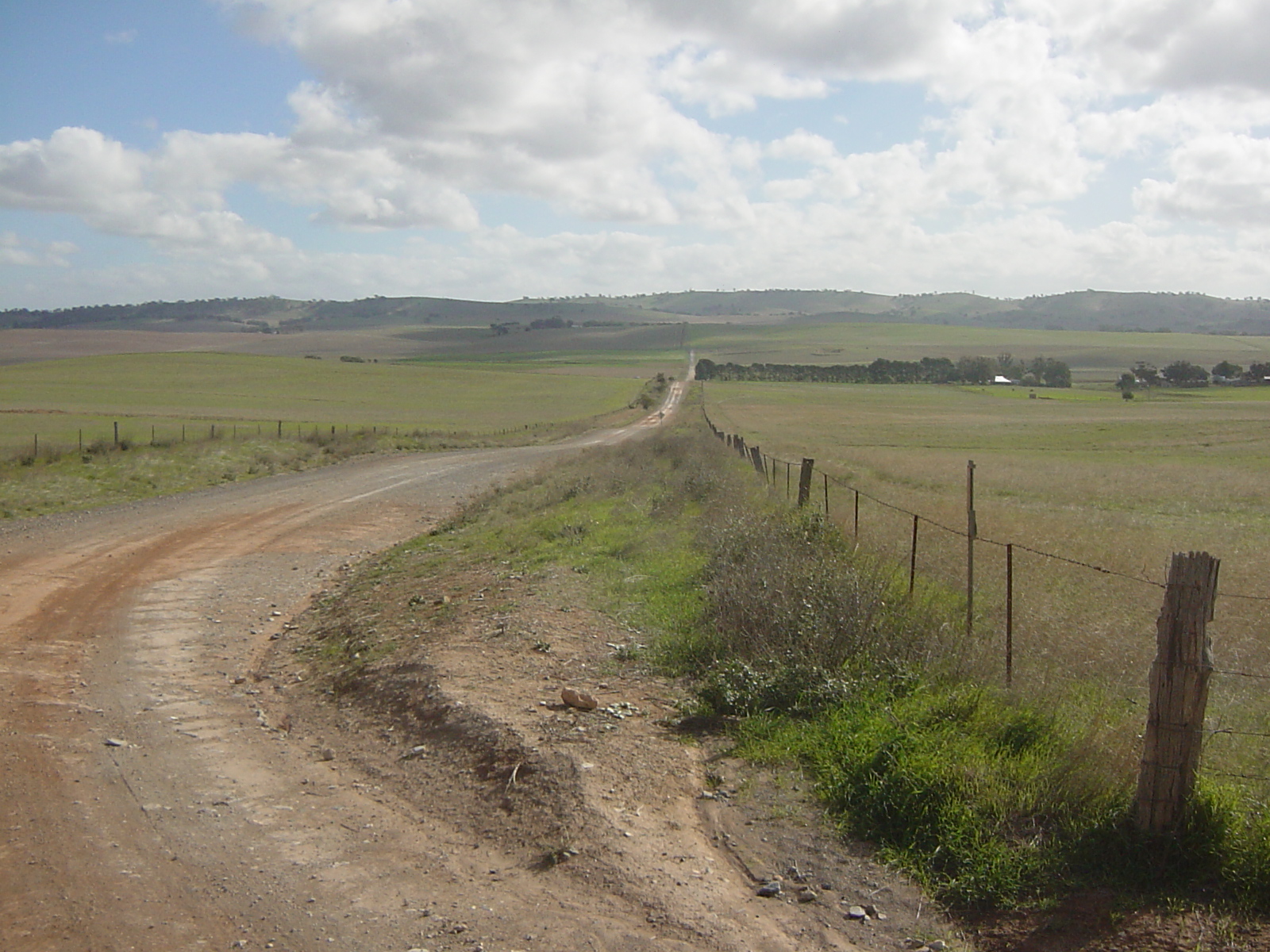
Venerable fence post
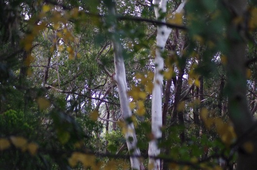
Forest lines
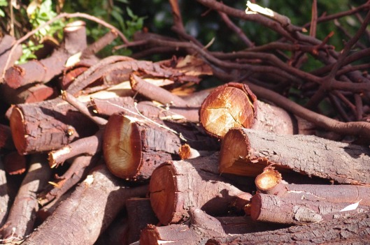
Black Wattle fire wood
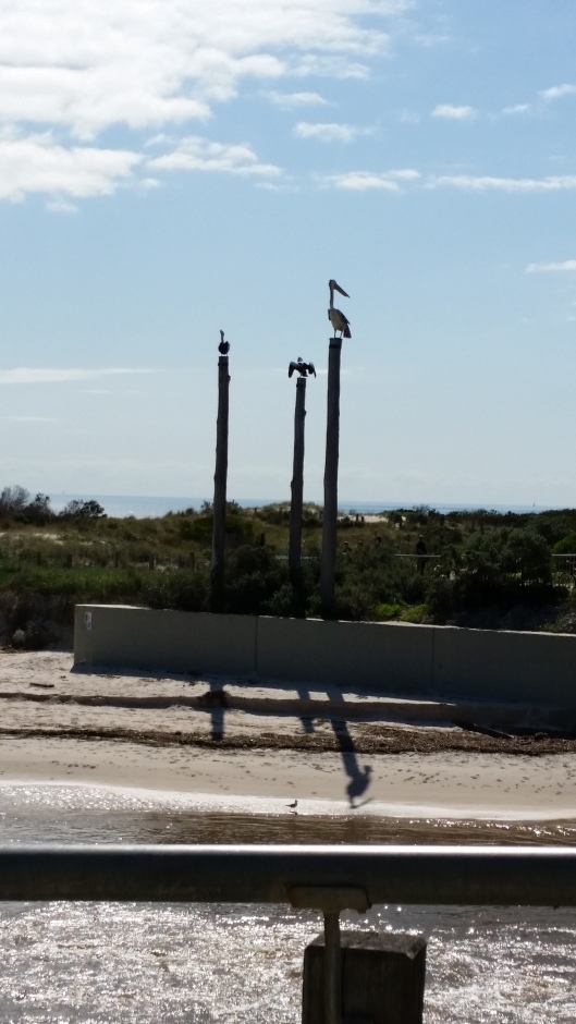
Pelicans
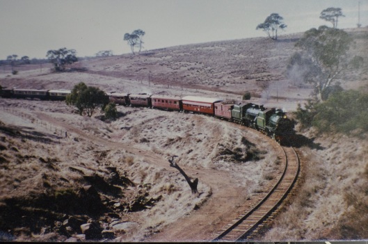
Train
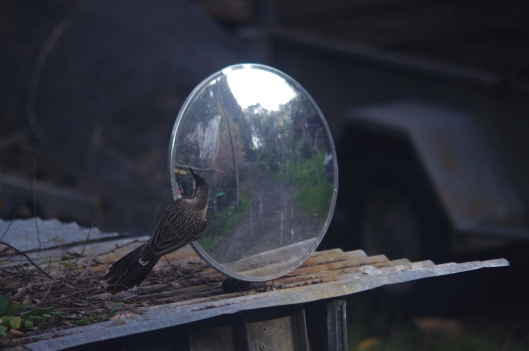
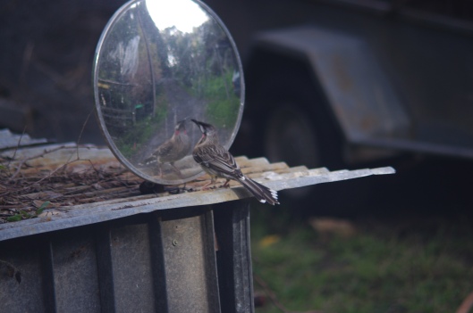
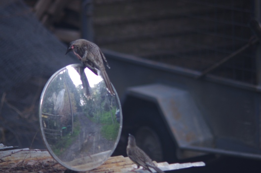
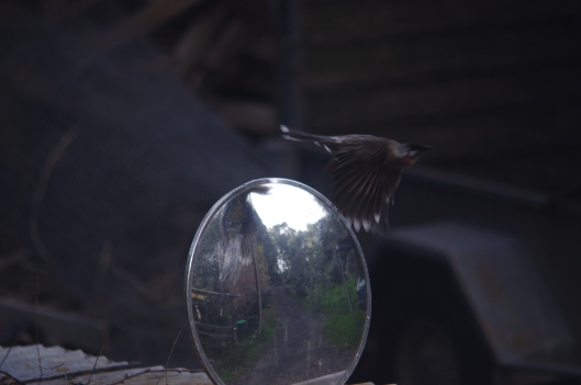
Wattle Birds


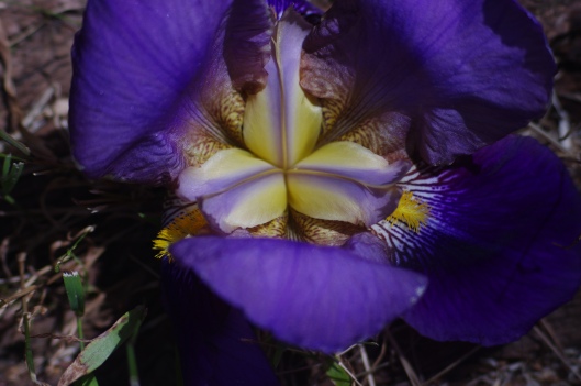
Irises

Super Moon

Pride of Madeira

09 Saturday Apr 2016
Posted in Uncategorized
Pentax KX 12MP DSLR with 80-200 manual zoom lens off my old 35mm KX SLR film camera
Venerable fence post
Forest lines
Black Wattle fire wood
Pelicans
Train
Wattle Birds
Irises
Super Moon
Pride of Madeira
09 Saturday Apr 2016
Posted in Uncategorized
Had a lovely ride around the dirt roads and forests near Mt Pleasant.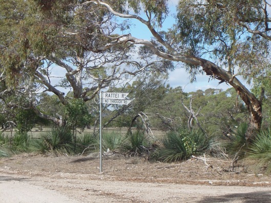
What lives down there?
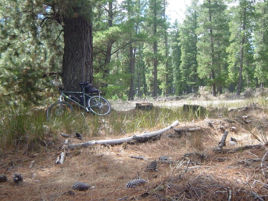
A shaded stump deep inside the quiet forest for a lunch stop.

Twisty vs straight.
08 Monday Jun 2015
Posted in Uncategorized
The rail trail best known to SA cyclists would have to be the Riesling Trail from Auburn to Clare. Nowadays it’s extended by the Rattler Trail from Riverton to Auburn and a northern extension to the locality of Barinia. My question was to work out what to do once you got there. The rail line used to continue northwards to Spalding and a good road follows the line for much of the 35km without an actual rail trail. The road to the east of the line is about half bitumen and half good dirt. On the western side of the line is another less used road that runs along the ridge top for a while. Pictures of my May 2014 round trip from Spalding to Barinia and back:

If old stone bridges are your thing there are a few here by the junction of the Spalding-Burra Rd and the road to Barinia. The railway bridge.

A succession of road bridges, missing, superseded and current

The bitumen section of the Hill River Rd ends at the locality of Andrews.

Typical farming land of the region, in the long parallel valleys of the Mid North of SA. The road is quiet and gravel surfaced, not terribly exciting.

Ascending from the valley bottom to the crest before Barinia.

Here is the northern end of the Riesling Trail at Barinia.

And the picnic bench at Barinia is where I stopped for lunch. Nothing much else there in the way of facilities.

The return to Spalding along Calcinia Rd, the other, western road.

And the road gets more interesting, now just an earthen track.

Big gums in the fields

Rolling hills
and descents with views

and more views from Hilltop Rd

and yet more views, a wind farm on the far away range.
After that it’s back down to Andrews and follow the bitumen road back to Spalding.
To sum up, the railway trackway isn’t the bit with the best scenery but it’s alongside an all weather road on the way to Spalding. The roads along the ridge made my day all the sunnier. Enjoy them if you can.
08 Monday Jun 2015
Posted in Uncategorized
In April 2014 I took a few pictures of the rail trail between Laura and Wirrabara but they had been forgotten about. Anyway, here they are.
On the northern side of Laura:

Lovely flat tree sheltered trail northwards:

At the Laura golf Club you meet a stile:

Through the Golf Club and the other stile:

The trail ends at the southern boundary of Stone Hut.

Cross the main road there and take the parallel side street instead, historic buildings to see:

At the northern edge of Stone Hut look back at the bakery (now closed) and take to the main road.

Stone Hut Common

A few km northwards and the rail trail reappears:

Nice gravel trail away from the main road, much better, until you get to the missing bridge:

The concrete pad is your creek crossing, not during a flood thank you.


Back on the trail to Wirrabara:

A lovely tree lined cutting:

And the end of the trail just west of the town centre of Wirrabara.

Oh and back near Stone Hut there’s a pretty little lookout above the town with a view towards the TV tower above the Wirrabara Forest.

Spot the birdie

Yes, that one.
16 Wednesday Apr 2014
Posted in Uncategorized
April 16th 2014
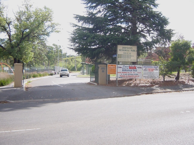
Well, on a beautiful autumn day I decided to ride the Amy Gillett trail from its beginning near Oakbank all the way to its new terminus at Mt Torrens. I parked the car at Balhannah Oval about 3km from the trail start as the main road from there to the trail head is on a 60km/h limit and reasonably safe to ride.
The road is busy but its mostly wide enough to ride safely. You could park at Oakbank Racecourse 2.5km on, near “Rotten Row”‘, the private camping ground for horse racing tragics.

From here there’s a 0.5km section of main road with bike lanes but you then have to wait for a break in the traffic to cross the road to the start of the trail.

The trail runs straight into a tree lined cutting shielding you from the road noise.

Not far onwards the first rest area appears, then you cross Gillman Rd where a few trail riders park their cars for a safer start.

As the trail follows the main road you pass old buildings and cross local side roads and the creeks that run into the Onkaparinga River to the left of the road.

Then at Woodside stage 1 of the trail ends unceremoniously just before the Woodside Oval and you have to ride on the road for a short distance.

The trail signs direct you left and then right into Station Street, a quiet lane behind the main street.

At a newly paved cul de sac stage 2 of the trail starts off to the left.

A tree lined laneway takes you down the old rail line between the houses.

Shortly the trail gets near the main road again at Woodside North.

The trail leaves the rail alignment as the main road has been built over it. The parking bay a bit further on is what’s left of the “S” bend associated with the old level crossing. For a short distance you ride on a slightly widened footpath past a number of businesses.

Approaching Charleston the trail spears off across the cow paddocks. In spring this is where a swooping magpie is known to live.

In Charleston stage 2 ends at Newman Rd and a short section of widened footpath leads you to the start of stage 3.

The stage 3 entrance is currently disguised as a private driveway, the bunting and keep out signs have just been removed but the welcome mat isn’t out yet. The trail restarts just down the laneway.

Back at the main road the new trail on a disused rail line on a new steel bridge overlooks the modern road on a thorougly old stone bridge. I’m sure the builders of that bridge never envisaged the traffic their bridge would one day carry or that the future rail line beside it would have such a short life.

Now the trail gets interesting in my opinion, scenic wise and engineering wise. It has to climb out of the Onkaparinga valley catchment and cross the watershed to the Torrens River catchment. The embankments have been built to cross the local creeks at a higher level than the adjacent road.

The local farmers have of course been using the old rail alignment for decades to cross this creek so their continued access involved building a new access track as well as the shared trail. Some fencing is still to be done alongside paddock boundaries but the safety fencing for the trail is all in.

Finally the trail reaches the watershed and recrosses the main road.

Along the road a bit to the turn off back onto the railway alignment.

Which then heads downhill in an arrow straight fashion.

Just west of Mt Torrens township stage 3 of the trail ends at the Oval road. This is about 18km trail kms from Oakbank. The Oval road looks like it’s being rebuilt for sealing in the near future.

Finally you can rest up on the front verandah of the oval clubrooms, public toilets are to the left of the picture. Food and drink is available at the general store on the main street of Mt Torrens or at the pub if you prefer.

I imagine there will be a stage 4 to Birdwood and a stage 5 to Mt Pleasant one day, it will be a great trail if it does. Tree cutting work just past the end of stage 3 suggests it may happen sooner rather than later. Here’s hoping for more of that excellent trail.
21 Saturday Sep 2013
Posted in Uncategorized
 Tansy trying my sandals on for size while Oscar lurks behind the lamp stand.
Sunny spring morning, a cardboard box full of fluff.

Alert But Not Alarmed

Winter has arrived and the Worshipful Company of Pussycats prostrate themselves on the altar of the Fire God.
18 Tuesday Jun 2013
Posted in Uncategorized

This gallery contains 36 photos.
(Updated 8 September 2013, see below) (Updated 30 December 2013 as well) (Final update 25 March 2014) Well I decided …
